In this lesson, you use an existing Revit model and build it on top of a site imported from a Google Earth KML or KMZ file. Then you export the model to a Google Earth KML or KMZ file that uploads in Google Earth.
- Click


 (Open).
 - Click Add-Ins tab
 Globe Link panel
 Import drop-down
 Import Google Earth File (KML/KMZ).
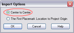
 The file imports into Revit and is positioned Center to Center, which means that the center of the imported Google Earth site boundaries is mapped to the center of the project site.

- Click Manage tab
 Project Location panel
 (Location) to display the location of the Revit building model. Its location matches the Google Earth location.
 - (Optional) Click Modify tab
 Modify panel
 (Move) or
  (Rotate) to adjust the site to a desired position on which to build the model. You can orient the project with respect to either the site or the background.
 - Click Add-Ins tab
 Globe Link panel
 Export drop-down
 Export Google Earth File (KML/KMZ).
 - In the Export Options dialog, select the required options and click OK.
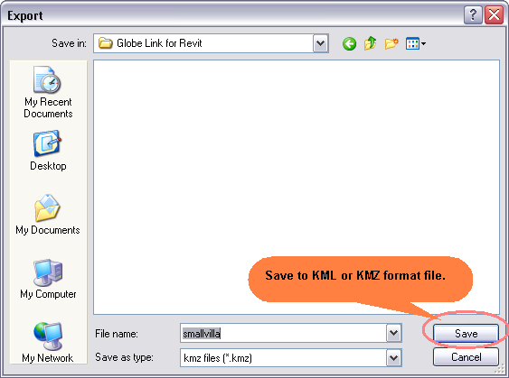
- From the Export dialog, navigate to the directory where you want to save this file, and click Save.

- Navigate to the file you just saved. Double-click to open it in Google Earth. The file opens in the correct geographical location.