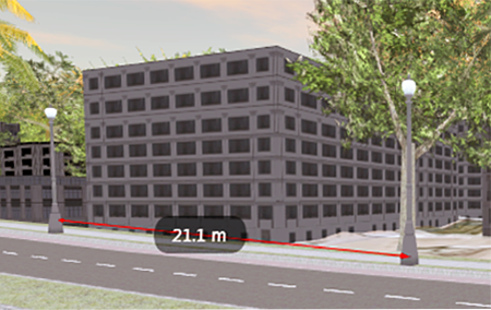
- Zoom out so you can see the points to measure.
- Click


 .
. - Click the starting point, and then click the end point.
The distance between the two points appears on the line between the points.

You can continue measuring distances between points by clicking more start and end points. Each one is labeled separately.
- To clear the most recent measurement, press Backspace. To clear all current measurements, press Esc. To show or hide all the measurements, press Space.
The tool is still active, and you can measure between two other points.
Advanced Tips
The distance will be measured even if the line between the two points is blocked by other objects.
The resulting distances are displayed as dimensions. A label shows distance values for each measurement, using the current unit of measurement.
You can take a snapshot of each point as it is measured, but you cannot record this as part of a storyboard.
While you are measuring, you cannot select or edit features.
Note: Point-to-point measurement does not take into account the variation of terrain. That is, the lines between points are not "draped" on the surface. For more accurate measurements across terrain, use polyline measurement.