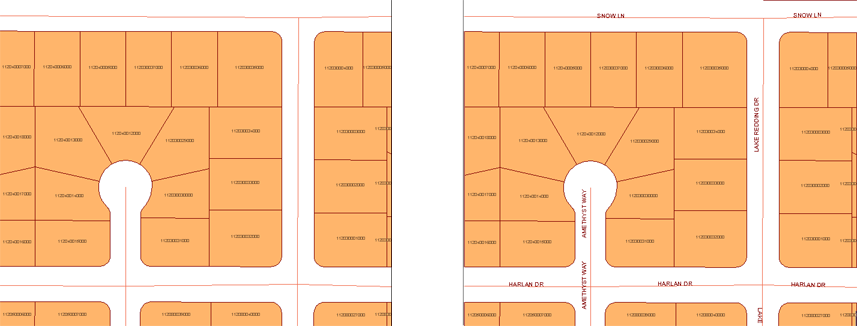
Labels mark each feature in the specified Display Manager feature layer. They are defined as part of the feature layer style.

This illustration shows labeling for polygon features (parcels) and line features (streets).
A label can contain text and/or non-textual, vector and raster graphics.
You can specify a property to display in the label. For example, you can label roads with their names. You can also use expressions in labels. For example, you can label parcels with an expression that determines the net value of the property, or use an expression to concatenate two properties, such as address and street name.
Each geometry type has its own positioning options. The labeling process determines where to put the symbols, and it places them so they do not cover each other, using the following parameters:
- Show labels at fixed locations relative to the feature, or repeat the label at intervals along the feature.
- Offset labels from the start, middle, or end of the line.
- Specify the interval at which labels will repeat.
- Specify a single-line label that follows a path and shrinks to fit.
When you label point features, you can also control the following:
- Specify that labels move automatically when they encounter another label, to avoid one label overlapping another.
- Specify vertical and horizontal offsets to control the anchor point for the label relative to its referencing point.
For performance reasons, the maximum number of labels drawn is 2000. If there are so many labels that geometry would be obscured if they were drawn, AutoCAD Map 3D does not draw them.