With AutoCAD Map 3D, you can combine data from maps using different coordinate systems. To do this, you specify the coordinate system used for attached drawings and for the current drawing. When you bring objects from attached drawings into the current drawing, the objects are transformed to the coordinate system of the current drawing.
The coordinate system you assign to your drawing specifies the system that was used when creating the drawing. For example, if you created a map using Universal Transverse Mercator, Zone 27, US Survey Feet, you assign the code UTM-27F to the map.

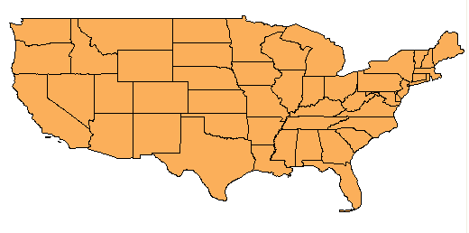
This map of the USA uses the Latitude-Longitude 84 coordinate system.
You specify the coordinate system used for the current drawing and for attached source drawings before querying any items from the source drawings. When you query objects from source drawings, AutoCAD Map 3D automatically converts them to the coordinate system of the current drawing. This operation is called coordinate transformation.When you save objects back to source drawings, AutoCAD Map 3D reverses the conversion. You can define your own transformations, in addition to the ones AutoCAD Map 3D provides.

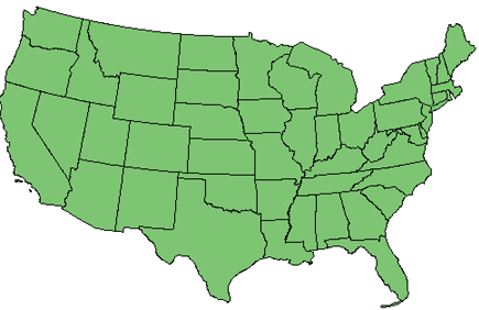
This map uses the Albers Equal Area coordinate system.
The coordinate system code and definition are stored in the drawing file. You can share the drawing with anyone using AutoCAD Map 3D Release 4 or later, and they will have the correct coordinate system.
When the coordinate system you select is assigned to the selected attached drawings, a backup file, with a .bak extension, is made of each source drawing before assigning the coordinate system information.
The coordinate systems supplied with AutoCAD Map 3D include the Universal Transverse Mercator System and the State Plane coordinate systems used in the USA, as well as many international coordinate systems used around the world. For a complete listing of supported systems, see the Coordinate System Library.
You can define your own coordinate systems, datums, ellipsoids, geodetic transformations, and geodetic transformation paths. When you define a coordinate system, you can use your own grid files.