Make sure that the MySQL server is accessible and that the database you want to connect to is available.
To connect to a MySQL database
- Click
 .
. - In the Create Spatial Data Source dialog box, select OSGeo FDO Provider for MySQL and click OK.
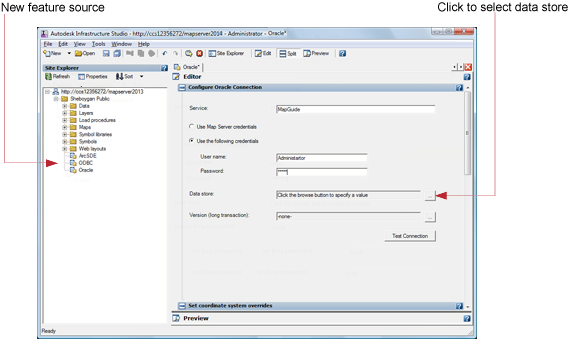
The Connection Editor is displayed to the right of the Site Explorer.
- Enter the server to connect to.
- Do one of the following:
- If the database is set up to recognize them, select Use Map Server Credentials.
- If the database requires them, select Use The Following Credentials and enter the userID and password.
- Select the data store from the list.
- Click Test Connection.
You should see a Successful Connection message.
- On the Autodesk Infrastructure Studio toolbar, click Save to store this connection resource in the repository.
Other Controls in this Dialog Box
- Version (Long Transaction)
-
If the provider provides this capability, select a long transaction name. A long transaction retains the context of an open transaction if it is interrupted and resumed.