During the load process, Infrastructure Map Server transforms source data into formats that are optimal for serving over the Web. Some formats are already optimal for use on the Web, including: Autodesk SDF, Autodesk DWF, and ESRI SHP. These formats are loaded directly without transformation. Other formats are converted into either SDF or DWF, which are the two native file-formats in Infrastructure Map Server. SDF is used for feature sources and DWF is used for drawing sources.
- Feature sources are the best choice when you simply want to load the raw geometry and then style or theme it in Infrastructure Studio.
- Drawing sources are best when you want to retain any styles or themes already applied to the source data.
For example, the diagram shows four views of a DWG file in Autodesk Map. The layer containing unstylized polygons (screenshot 1 at top) is converted to a feature source, because it contains simple geometry. The Display Manager styles and themes (3 and 4) already have some stylization, and so they are converted to drawing sources. There is also a polygon layer that has some stylization (2). In this case, you can choose to convert the layer either to a feature source (and lose the stylization) or to a drawing source (and keep it).
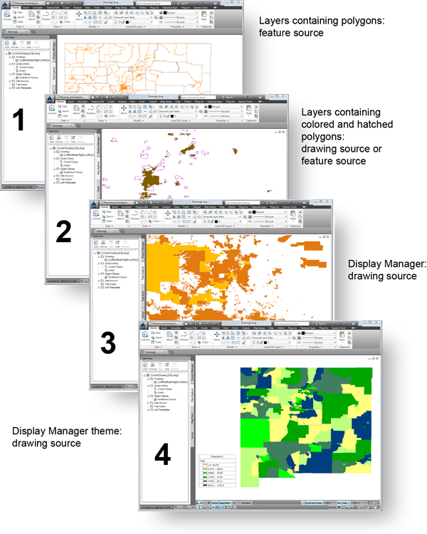
Views of a DWG file in Autodesk Map, showing options for converting to feature sources or drawing sources