Make sure that the service you want to connect to is available and that you have the correct URL.
To connect to a web feature service (WFS)
- Click
 .
. - In the Create Spatial Data Source dialog box, select OSGeo FDO Provider for WFS and click OK.
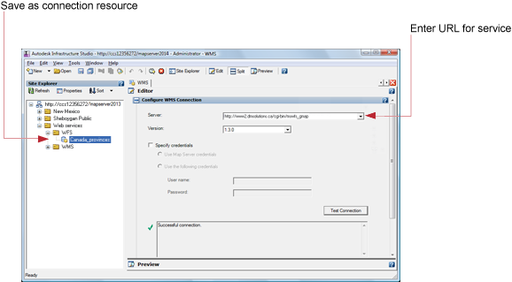
The Connection Editor is displayed to the right of the Site Explorer.
- Enter the URL to connect to.
If you are connecting to feature sources that have been published to Infrastructure Map Server, the connection string looks like this:
-
http://servername/mapserver/mapagent/mapagent.fcgi?
- If the server requires a password, do one of the following:
- If the service is set up to recognize them, select Use Map Server Credentials.
- If the service requires them, select Use The Following Credentials and enter the user ID and password.
- Click Test Connection.
You should see a Successful Connection message.
- Click Refresh to reconnect to the server and display the feature source information in the WFS editor.
- Click Edit Coordinate System to overrride the original feature source coordinate system.
- On the Autodesk Infrastructure Studio toolbar, click Save to store this connection resource in the repository.
Note:
To revert to the original state of a particular element, select it, and then click Restore.