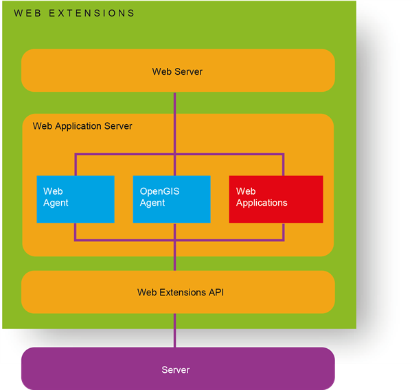
The Autodesk Infrastructure Web Server Extensions are internal components which can be accessed through the Web Server Extension API. (There is also a forms-based interface which you can access: http://servername:port/mapserver2012/mapagent/index.html). The Web Server Extensions expose the services offered by the Infrastructure Map Server to client applications over the Internet or an intranet using HTTP protocol. The diagram on the facing page shows the main sub-components of the Web Server Extension.
The WebAgent processes requests coming from clients and passes them to the Infrastructure Map Server. Two of the clients are Infrastructure Studio and the Infrastructure Map Server viewers. The WebAgent implements the Infrastructure Map Server services HTTP Protocol, which it uses when directing requests to the server. The WebAgent processes incoming request parameters, establishes a connection to the appropriate server, and calls the service API(s) required to process the request. When the service API responds, any data returned from the API is streamed back to the client.
The OpenGIS Agent implements a number of the OpenGIS web-mapping protocols to expose the services offered by the Infrastructure Map Server to standards-based OpenGIS clients.
The Web Server Extensions provide a platform for application development, based on the services offered by the Infrastructure Map Server. The Web Extensions API supports three languages/environments: ASP, JSP, and PHP.
For more information, see the Developer’s Guide.
Architecture of the Web Server Extension