A point cloud is a AutoCAD Civil 3D object created by importing 3D point data.
In AutoCAD Civil 3D 2016, you can create a point cloud object and manipulate its style and display properties.
When you import a point cloud source data file, AutoCAD Civil 3D processes this data and creates an external point cloud database. The point cloud database is a collection of three files: .iati, .isd, and .prmd. The ISD (.isd) file format is the primary point cloud database format.
Point Cloud Components
A AutoCAD Civil 3D point cloud object contains the following components.
- Bounding box. The size and geometry of the bounding box component depend on the point cloud object minimum and maximum coordinate values. The bounding box serves as a point cloud object proxy when the point cloud source data is not accessible.
- Point cloud points. This component represents the data points that build the point cloud object.
You can control the appearance of both point cloud components using the point cloud style settings. The bounding box display properties include Visibility, Layer, Color, Linetype, LT Scale, Lineweight, and Plot Style. The properties that are applicable to the point cloud points component include Visibility, Layer, and Density. See To Display and Stylize Point Clouds.
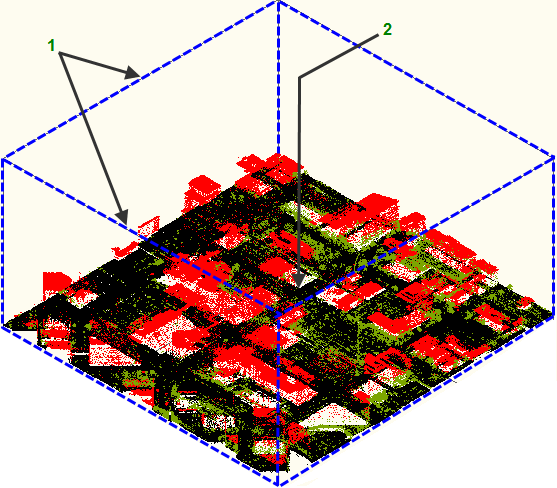
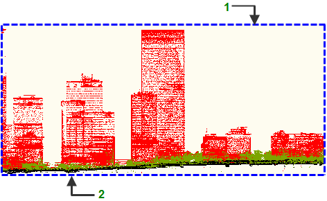
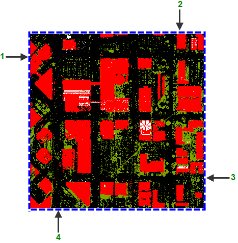
The following illustrations show the different views and the basic components of a point cloud object.
1 - Bounding box, 2 - cloud point data

The isometric view of a point cloud object shows the following point cloud components:
1 - Maximum Z-coordinate, 2 - Minimum Z-coordinate

The front view of a point cloud object.
1 - Minimum X-coordinate, 3 - Maximum X-coordinate
2 - Maximum Y-coordinate, 4 - Minimum Y-coordinate

The top view of a point cloud object.
Point Cloud Collection (Prospector Tab)
Use the Point Cloud collection in the Prospector tree to access point clouds in a drawing. As point cloud objects are created, they are displayed as named point clouds under the Point Clouds collection.