If your point cloud includes real view indicators and descriptions, you can turn their display on and off from the Real View drop-down menu.
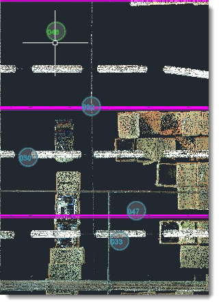
Indicators appear as circles as shown in the following example. Clicking on an indicator launches a photo-realistic panoramic view of the selected area. Labels appear as text over the circle to help you identify the region. Even if your point cloud is set to invisible, you can opt to display the indicators and/or labels.
To set label and indicator visibility:
- Locate the Real View option in the Point Cloud area of the Factory ribbon.
- Click the down-arrow to display the options:
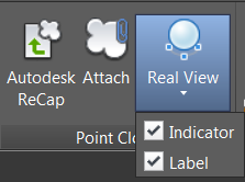
- Select Indicator to display the circles. Select Label to display the descriptions.