Quantification allows you to modify the property mapping of the files you use for takeoff. You can customize property mapping at individual and global level in the Quantification Item catalog. This level of customization should be sufficient for the majority of projects, and should be your first step if you want to modify takeoff properties. For more in-depth, technical customization, you can edit the XML takeoff property map file. Any property maps created in Autodesk Navisworks 2014 can be used in both 2014 or Autodesk Navisworks 2017.
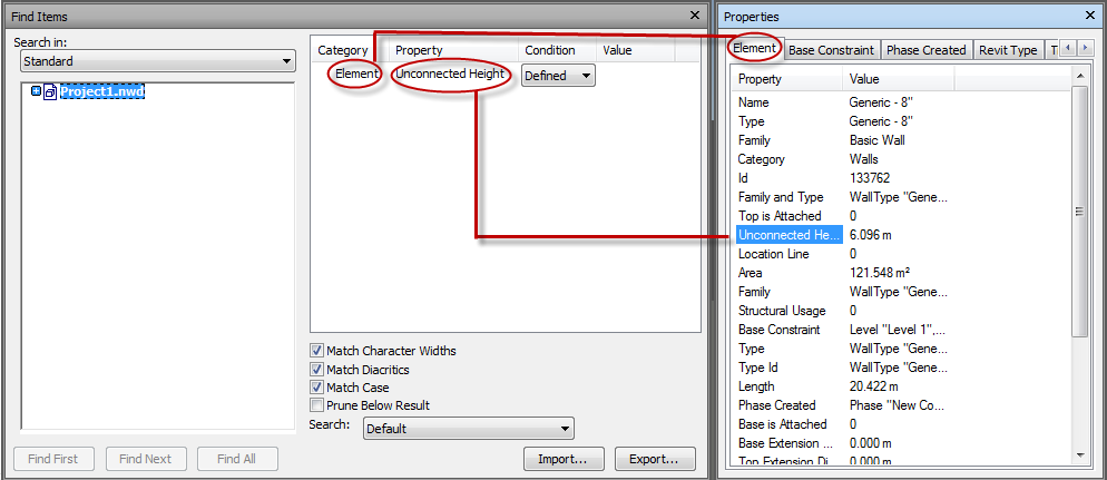
A key part of this process is locating items with specific model properties in the Find Items window, exporting those properties into an XML file, and modifying them to map to your chosen takeoff property. It may be helpful to view the Find Items and Properties windows side by side:

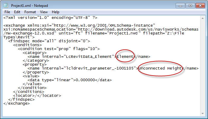
In the image above, notice how the Element category in the Find Items window (left) is shown as the Element tab in the Properties window (right), and Unconnected Height is displayed in the Property column in each window. You can then Export in the Find Items window to produce an XML file as shown below. Notice how Element and Unconnected Height are coded:

You can then customize these and other properties in different nodes or code sections of the file, to map to a specific takeoff property. In this case, you could map Unconnected Height to the takeoff property, Height. You then either copy them into your master map (TakeoffPropertyMap.xml) or into a new map. Once saved and Quantification is reopened, your new property values are visible. We have created three topics that show three different customization scenarios:
- To Modify Properties in the TakeoffPropertyMap node. This is an extension of the example shown above. It explains how to map the model Property "Unconnected Height" to the takeoff Property "Height". You can modify this example to help you configure mappings for different properties, for example, ModelHeight or ModelLength.
- To Modify Properties in the TakeoffFIleMap node. This explains how to configure different mappings for different file types, such as Revit and DWG. You should only put one file type in one property mapping configuration file. If you need multiple file types, you must use multiple files.
- To Modify Properties in the TakeoffObjectMap node. This lets you configure different mappings for different object types, such as walls, columns or doors.