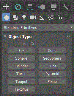
Plane : GeometryClass
Plane - superclass: GeometryClass; super-superclass:node - classID: #(136257020, 2002153317)

Constructor:
Properties:
<Plane>.typeinCreationMethod Integer default: 0 -- alias: Creation_Method
Set the creation method:
0- Rectangle (Creates the plane primitive from one corner to the diagonally opposite
corner, interactively setting different values for length and width.)
1- Square (Creates a square plane where length and width are equal.)
<Plane>.typeinPos Point3 default: [0,0,0] -- alias: type_in_position
Position of the plane in the World Space Coordinate system.
<Plane>.typeinLength Float default: 25.0
Length of the plane object.
<Plane>.typeinWidth Float default: 25.0
Width of the plane object.
<Plane>.length Float default: 25.0 -- animatable
Length of the plane object.
<Plane>.width Float default: 25.0 -- animatable
Width of the plane object.
<Plane>.lengthsegs Integer default: 4 -- animatable, alias: Length_Segments
Number of divisions along the length of the plane object.
<Plane>.widthsegs Integer default: 4 -- animatable, alias: Width_Segments
Number of divisions along the width of the plane object.
<Plane>.density Float default: 1.0 -- animatable
Specifies the factor by which the number of segments in both length and width are
multiplied at render time.
<Plane>.renderScale Float default: 1.0 -- animatable, alias: Render_Scale
Specifies the factor by which both length and width are multiplied at render time.
Scaling is performed from the center outward.
<Plane>.mapCoords Boolean default: false --alias: Mapping
When on, generates texture coordinates for applying mapped materials to the plane.
NOTE:
The
renderScale property is a multiplier applied to the Plane's
length and
width property values at render time.
The
density property is a multiplier applied to the Plane's
lsegs and
wsegs property values at render time.
Interfaces:
Interface:realWorldMapSizeInterface
Properties:
.realWorldMapSize: boolean : Read|Write
Enables/disables the real-world map size option. Available in
3ds Max 8 and higher.


