When you create a model, specify its geographic location using the address, nearest major city, or latitude and longitude.
To specify the geographic location
- Click Manage tab
 Project Location panel
 (Location).
- On the Location tab, for
Define Location by, select one of the following:
- Default City List: Allows you to select a major city from a list, or enter a longitude and latitude.
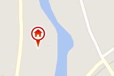
- Internet Mapping Service: Allows you to select a location using an interactive map, or enter an address. (Requires an Internet connection.)
Note: If this option is set to Get Location From Survey Point, coordinates from a linked DWG file define the survey point and the geographic location for the model. The GIS Coordinate System, Latitude, and Longitude fields display location information acquired from the DWG file. See About Using Grid Coordinates from a Linked DWG. You cannot select another value unless you remove the DWG link. - Enter or select the desired location.
For details, see Location Weather and Site Dialog: Location Tab.
- Optional: For energy analysis, select a nearby
weather station from the list.
Note: To see weather stations in the map and in the list, you must be signed into your subscription-enabled Autodesk account.
- If the model is located in an area that observes daylight saving time and you want shadows to be adjusted accordingly, select Use Daylight Saving time.
- Click OK.