This dialog enables you to edit the azimuth and elevation angles on all curve points:
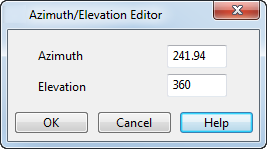
The azimuth and elevation angles are measured using the principal plane. To help explain azimuth and elevation angles, we will assume that the principal plane is the XY plane. Therefore, the Z axis is perpendicular to the principal plane.
Azimuth — If you look vertically downward onto the XY plane, the azimuth
 is the angle made by the tangent of the curve and the X axis
 :
:
It can take any value in a 360 range, but you may find it easier to work with values in the range -180 to +180. For example, azimuth angles of 270 and -90 are the same.
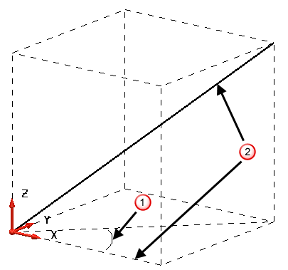
Elevation — The elevation angle
 is the one between the tangent of the curve and the XY plane
 :
:
Elevation angles make sense only between 0 and 90, and between 270 and 360. You can enter any angle for elevation, it will be displayed as the equivalent angle between the two valid ranges. For example, if you enter a value of -45, the elevation is displayed as 315 in the dialog.
or 270 (that is along the Z axis), you cannot modify the azimuth angle.