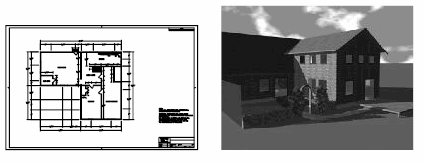
Raster images consist of a rectangular grid of small squares or dots known as pixels. For example, a photograph of a house is made up of a series of pixels colorized to represent the appearance of a house. A raster image references the pixels in a specific grid.

Raster images, like many other drawing objects, can be copied, moved, or clipped. You can modify an image with grip modes, adjust an image for contrast, clip the image with a rectangle or polygon, or use an image as a cutting edge for a trim.
The image file formats supported by the program include the most common formats used in major technical imaging application areas: computer graphics, document management, engineering, mapping, and geographic information systems (GIS). Images can be bitonal, 8-bit gray, 8-bit color, or 24-bit color. Images with 16-bit color depth are not supported.
Several image file formats support images with transparent pixels. When image transparency is set to on, the program recognizes those transparent pixels and allows graphics in the drawing area to “show through” those pixels. (In bitonal images, background pixels are treated as transparent.) Transparent images can be gray-scale or color.
Supported Raster Image File Formats
| Format | Extension |
|---|---|
| Adobe Photoshop Format | .psd |
| Arc/Info ASCII Grid Format | .asc, .txt |
| Arc/Info Binary Grid Format | .adf |
| Autodesk Animator | .fli, . flc |
| CALS Type | .cal, .mil, .rst, .cg4, .gp4, .cals |
| DDS (HDR) Format | .dds |
| Digital Terrain Elevation Data | .dt0, .dt1, .dt2 |
| ECW Compressed Image Format | .ecw |
| FAST-L7A | .fst |
| GIS-GeoSPOT | .bil, .bip, .bsq |
| Graphics Interchange Format | .gif |
| HDR Format | .hdr, .pic |
| ILM OpenEXR Format | .exr |
| Image Systems CCITT Group 4 | .ig4 |
| JPEG File Interchange Format | .jpg, .jpeg |
| JPEG2000 | .jp2, .j2k |
| Macintosh PICT | .pct, .pict |
| MrSid | .sid |
| Native Format DOQ | .doq, .nws, .nes, .ses, .sws |
| NITF | .ntf |
| Portable Network Graphics File | .png |
| QuickBird Tagged Image File Format | .tif, .tiff |
| RLC | .rlc |
| Tagged Image File Format | .tif, .tiff |
| Truevision Targa | .tga |
| USGS Digital Elevation Model | .dem |
| Windows Bitmap | .bmp, .dib, .rle |
| ZSoft PC Paintbrush | .pcx |