A parcel boundary is a closed polygon. The points where line segments join are called nodes. There are two segment types: line and curve.
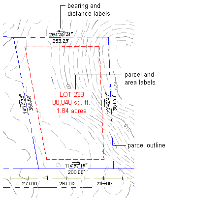
Each parcel has an area label, which refers to the parcel as a whole. You can click the area label to select the parcel. A parcel can also have segment labels, and associated tables, which display information about the parcel. Labels can contain user-defined property fields.
Each parcel maintains information about its segments and nodes, and the area they enclose. Editing parcel segments dynamically updates the parcel properties. Deleting a segment can result in one parcel merging with another.
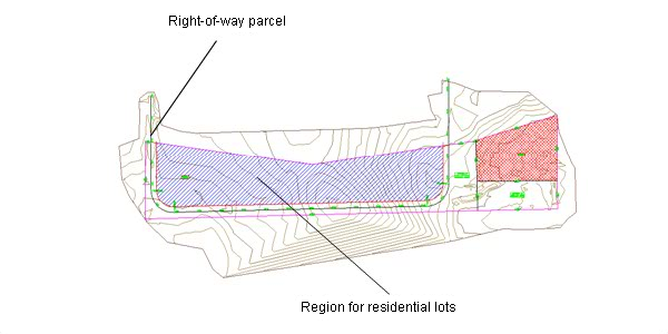
Parcel region before subdivision into individual lots