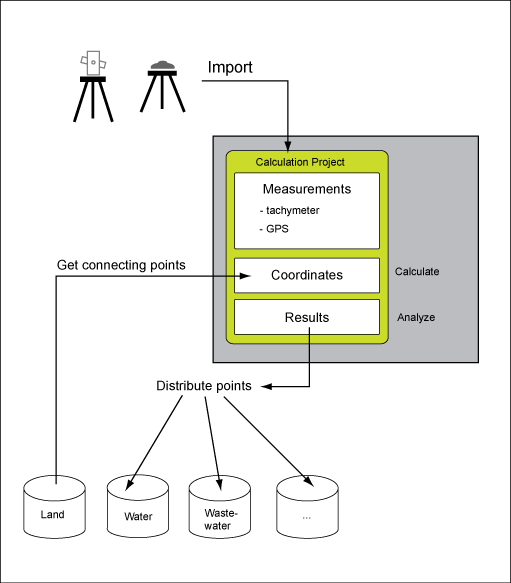
Use AutoCAD Map Survey to import and process field measurements in industry model drawings and the enterprise industry model . The module provides tools to import terrestrial and GPS survey data. You import the field data, and calculate the coordinates in a survey database schema. Then, you use statistical quantities to analyze the results, and distribute the coordinates to the appropriate industry models, such as Water, or Wastewater.

Survey can be used with or without AutoCAD Map 3D toolset (standalone version). When you use the Survey standalone version, you cannot display the network plan. However you can run the adjustment calculation, and create the network plan offline. For example, use the standalone version when you come back to the office from the field, to save your measurements on the computer and free the memory of the instrument. Generally you can calculate the adjustment and distribute the points in standalone mode. However if errors and warnings occur, it is easier to find errors using the display of the results in the drawing.
Survey Database
Survey stores measurements, calculation settings, and results in a separate database schema. Use Infrastructure Administrator to create the Survey database. See Creating the Survey Database.
Adjustment Calculation
Survey calculates point coordinates using an adjustment process that is based on least squares. Up to now network adjustment has mainly been used for high precision networks. However, using adjustment calculation for detail points has the following advantages.
- You integrate all observations in one adjustment calculation.
- You apply statistical testing to detect measurement errors.
For each point the precision and reliability is stored in the database.
The adjustment calculation consists of two steps:
- Calculation of approximate coordinates.
- Adjustment calculation (least squares adjustment).
The calculation consists of a 2D adjustment for the plane coordinates (easting/northing), and a 1D adjustment for the height.
The adjustment results are displayed graphically in a network plan and in reports.