Distribute your geospatial data, maps, and designs in various ways.
Share Data
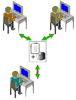
AutoCAD Map 3D toolset makes it easy to share data, both within and outside your organization.
 |
When you edit data in the original source, your changes are immediately visible to others in your organization. |
Send Maps to the Field

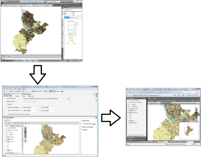
The original map in AutoCAD Map 3D toolset is at the top. On the lower left, the map appears in Autodesk Infrastructure Studio. On the right, the map is displayed in a web browser.
- Plot/print single-page or multi-page maps to paper or to a file.
- Use
map books to divide a large map into tiles, which are rendered on separate pages. You can include a legend, title, and other information on each page.
You can produce maps with insets using map books.
- Publish maps to the internet using Autodesk Infrastructure Map Server software.
All layers, layer definitions, dynamic labels, queries, filters, and styles (including point, line, raster, and other styles) in your map are published. If you set up styles for different zoom levels, the appearance of the map changes as the end-user zooms in our out in a web browser. Zooming changes the appearance based on the styling rules you established in AutoCAD Map 3D toolset.
- Publish your map as a single HTML page. The result is a “snapshot” of the map that anyone can view in a web browser.
- Save maps in
Autodesk DWF format to use with Autodesk Design Review (a free, downloadable viewer). Distribute or post the results on the web or on an intranet. You can create map books in DWF format.
If you assigned a coordinate system to all the maps in your DWF file, the publishing operation automatically converts the coordinate information to latitude/longitude coordinates. Autodesk Design Review 2008 can automatically navigate to a specific location when you enter coordinates. It displays coordinates of any location in the map when you move your mouse over that location.
- Export to another format, such as DGN or SHP.
- Create comma-separated reports as text files, listing information about objects in attached drawing files. You can import the report files into a spreadsheet, database, or document.
- Use eTransmit to package all the files your map uses and send them to another AutoCAD Map 3D toolset user.
Tell me more
|
|
|
|
|
|
|
|
 Procedures
 Tutorials
 Related topic
 Video
Video