You can filter or select data by specifying a location in your map. For example, you can find all roads within 100 meters of a power line, or all parcels within a specific section of the drawing.
When you specify a location condition in an expression, you switch to your map and draw the location manually. For example, if you want to find all parcels within a circular area, you draw the circle on your map. As soon as your designation is complete, you return to the expression.
You cannot use location filters for labels or calculations.
In the following illustrations, the objects that are retrieved are highlighted.
| Location Type | Items retrieved |
|---|---|
| Inside Circle |
 |
| Inside Rectangle |
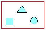 |
| Inside Polygon |
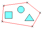 |
| Touching any part of a circle |
 |
| Touching any part of a rectangle |
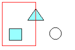 |
| Touching any part of a polygon |
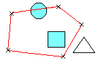 |
| Touching any part of a fence (line) |
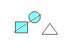 |
| Touching a point |
 |