AutoCAD Map 3D 2021 toolset contains customer-focused enhancements across the product. The following is an overview of the changes made to the AutoCAD Map 3D 2021 toolset release.
Dark Theme Support
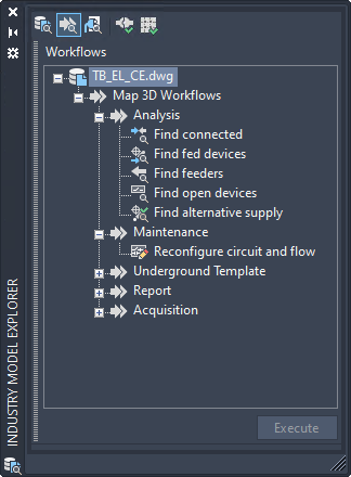
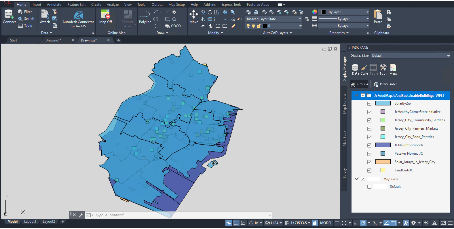
The dark theme has a modern dark blue interface that's designed with contrast improvements and sharper icons.

For better visual experience, the industry model ribbon controls and explorer views such as Industry Model explorer, Workflow explorer, Electric explorer, and so on, have been updated to support the dark theme in AutoCAD Map 3D 2021 toolset.

ArcGIS Data Edit Enhancements
In AutoCAD Map 3D 2021 toolset, you can edit the features of the data from ArcGIS Online or Portal for ArcGIS Enterprise. The edit and feature options depend on the settings per feature layer in ArcGIS Online or Portal for ArcGIS Enterprise. The changes made to the features are saved to the ArcGIS Online or Portal for ArcGIS Enterprise when you check them in.

FDO WMTS Support
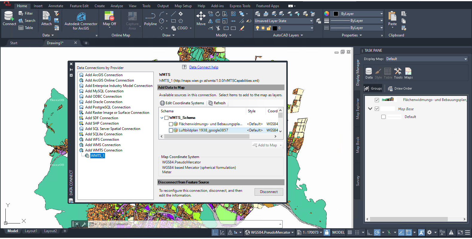
AutoCAD Map 3D 2021 toolset now allows you to access the Web Map Tile Service (WMTS) data and bring them into your drawing. For more information, refer to the Help topics about WMTS.

Other Enhancements
- New Support for Oregon Coordinate Reference System (OCRS).
- Extended support for the following FDO providers to newer versions:
- FDO SQLite: SQLite 3.27.2
- FDO SQL Server Provider: Microsoft SQL Server 2019 Standard and Enterprise Editions
- FDO Oracle Provider: Oracle 19c (19.3)
Note: Due to a known problem that exists from Oracle 12.2, you are recommended to configure the system when working with the industry models job in Oracle 12.2 or later versions.
- Run the SQL command.
ALTER SYSTEM SET "_allow_insert_with_update_check"=TRUE scope=spfile
- Restart the database.
- Run the SQL command.
- The following customer issues have also been resolved in
AutoCAD Map 3D 2021:
- Using MAPPOLYLINETOPOLYGON with the HPCOLOR system variable set to a specified color may cause AutoCAD Map 3D 2020 to crash.
- Occasional crashes while updating style on the drawing data layer.
- When using CO83-CF and UTM-32N coordinate systems, some data from the ArcGIS Online may not be displayed accurately.
- When the proxy is set using PAC file, AutoCAD Map 3D 2020 may not connect to the ArcGIS Online.
- When all layers from a SHP folder are added to a drawing, the edit features across multiple layers may not work as expected.
- Some WFS URLs may not work in AutoCAD Map 3D 2020.
- The grayscale style in some 32-bit raster files may not work accurately.
- In a file-based (SQLite) industry model, the expression engine may not recognize the attribute from a view that contains functions such as coalesce() or ifnull().
- The Report Designer may not accurately display the report in landscape format in the designer area.
- In the Geometric Validation dialog box, the feature class list may not be sorted.
- Creating a new plot template with job explorer open may cause AutoCAD Map 3D 2020 to crash.
- When using the Data Checker, the results may not be sorted according to the parent and name checks.
- Moving the pipe with label definition containing relative labels and then added to the parent geometry selection SQL statement may cause AutoCAD Map 3D 2020 to crash.
- AutoCAD Map 3D 2020 may freeze when exiting plot preview.
- For a drawing with FDO connections and XREF, saving it in maximized viewport may cause AutoCAD Map 3D 2020 to crash.
- Structural point POLE in the form is not added to the Electric explorer.
- FDO layer stylization does not respect the lineweight values of the original symbol.
- The symbol lost height scale using DWT with MAPTOACAD command.
- The calculated useful range of the Swiss coordinate system EPSG:2056 is incorrect.
- In AutoCAD Map 3D 2020, the query does not work with Oracle number column.
- Creating a transmittal package (eTransmit) using a folder with SHP files may cause AutoCAD Map3D toolset to crash.