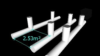
To calculate an area on a plane
- Click Review tab
 Measure panel
  Measure drop-down
  Area
Area .
. - Click to register a series of points to describe the perimeter of the area you want to calculate. The optional dimension label displays the area of the perimeter described since the first point, as projected onto the plane of the viewpoint.
 Note: For your calculation to be accurate, all added points must be on the same plane.