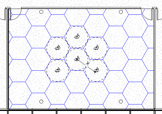
Use a spatial grid to add an overlay to a room to visually analyze spatial requirements for distancing.
The spatial grid is a filled region applied to a selected room. Define the pattern, square or hexagon, and the distance of the grid spacing as you add the spatial grid to a plan view.
When a Spatial Grid is placed a filled region type is created and a corresponding model type of the specified distance is created and used as the foreground fill pattern for the filled region. If a filled region type and model pattern already exist for the specified spacing, the existing types will be used.
For Example: You place a Spatial Grid and specify a hexagon grid with a spacing of 2m. A filled region type and model pattern with the names "SpatialGrid_Hexagon_2m" will be added to the model. If instead you specify a square grid with a spacing of 6 feet, a filled region type and model pattern will be created with the names "SpatialGrid_Square_6ft".
Use the Spatial Grid in conjunction with People Content to understand distancing requirements in rooms.