Geotechnical Modeler
The Autodesk Geotechnical Modeler is a Civil 3D extension that enables you to visualize and analyze your geotechnical data directly within the Civil 3D environment.

In this month’s Have You Tried article, we’ll take a closer look at the Geotechnical Modeler feature in Civil 3D.
Each month, we profile a useful feature or workflow in Civil 3D. We look across what's new, what's been around for a while, and identify features that could improve your experience with Civil 3D while making you and your team more productive.
Have a feature you want to see covered? Tell us about it in the comments.
What is it?
The Geotechnical Modeler extension enables you to import and connect your geotechnical data directly within the Civil 3D environment. The Geotechnical Modeler provides tools to easily generate stratum surfaces, create subsurface visualizations of geotechnical data in profile views, and transpose profile information into a three-dimensional view. The workflows should be familiar to all users of Civil 3D software as the tool uses a variety of Civil 3D objects and styles.
Why use it?
The flexibility of the Geotechnical Modeler gives you the ability to create and manage standard Civil 3D object types and styles including: COGO points, TIN surfaces, alignments, profiles, and profile views. The Geotechnical Modeler provides you with two options for connecting subsurface data to your Civil 3D projects: through the industry specific AGS file format option or using simple CSV files.
Where do you find the tool?
To access the Geotechnical Modeler dialog boxes, do the following:
From the ribbon, select the Geotechnical Modeler tab ![]() Select the appropriate Geotechnical Modeler interface to open:
Select the appropriate Geotechnical Modeler interface to open:

You can also choose to enter the command prefix GM from the command line as an alternate method to access the Geotechnical Modeler dialog boxes. The following commands are available from the command line to access the Geotechnical Modeler dialog boxes:
- GM_ManageData
- GM_BuildSurfaces
- GM_StratumSurfaceDisplay
- GM_SubsurfaceProfiles
- GM_Help
Workflow
Importing Geotechnical Data
The Geotechnical Modeler supports both the industry specific AGS file format and the more generic CSV file format when importing geotechnical data into a Civil 3D project. If you use dedicated geotechnical or subsurface software that supports the AGS format, you can easily connect that geotechnical data to Civil 3D projects.
The CSV format allows you to develop and enter data in a simple text-based file format without needing to use specialized software when AGS data is not available for your project.
Add Subsurface Profile
Creating Surfaces from Borehole Data.
The Geotechnical Modeler allows for the creation of various surfaces using the project dataset. There is an option to build stratum surfaces using different Geology fields contained in the data set. To build the surface using a different Geology field, select the desired field and then select Build Surfaces.
In addition to interpolating between boreholes, the Geotechnical Modeler also provides you with the option to follow existing ground for better subsurface visualization.
Visualizing Geotechnical Data
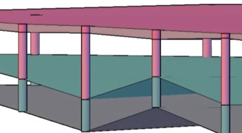
After importing your Geotechnical Modeler information into the model, you can create stratum surfaces that will represent each material layer from the borehole data. You can control the display of the stratum surfaces for the plan view and the model view separately.
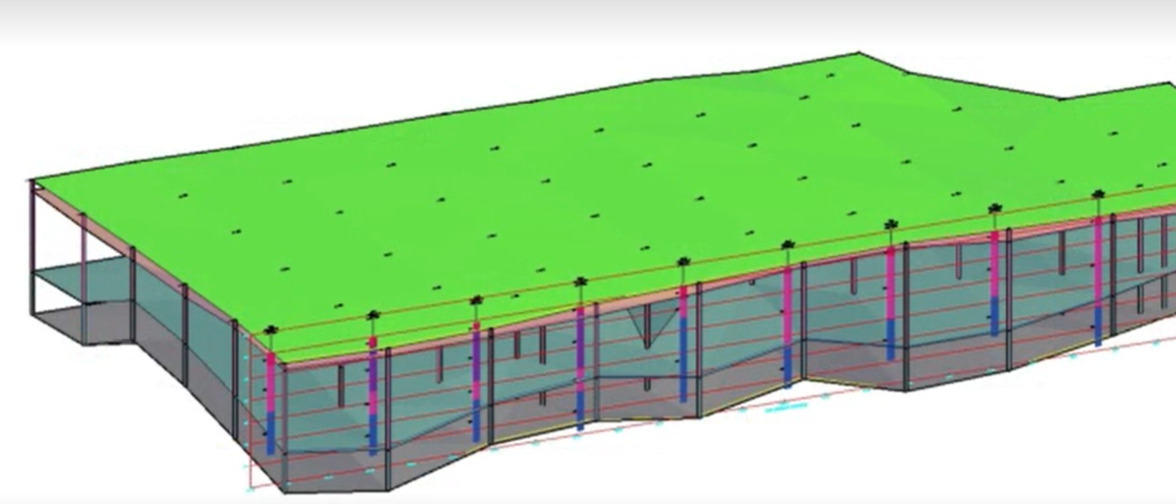
If you want to better visualize borehole data, you can create 2D sticklogs to better understand the geotechnical data. You can also create 3D sticklogs to view the boreholes stratum surface in 3D.

A subsurface profile view represents the different stratum profiles and the boreholes themselves. Select the boreholes you'd like to add to the profile and they're added when the profile view is generated. The profile view can be utilized in the design plan sheets but can also be added in 3D.
Bringing this information together in a 3D view can help you to make better design decisions. You can also import the model into InfraWorks from Civil 3D allowing stakeholders to have a better understanding of problems when working on the site design.
Exporting Data
The Geotechnical Modeler includes a tool to allow you to export subsurface model data to a new Civil 3D drawing.
To share 3D boreholes and stratum surfaces:
- Open the 3D Export dialog by selecting 3D Export.
- From the dialog box select the object type (3D boreholes or stratum surfaces). to export to a new drawing.
- Select surfaces from the provided list from the Surfaces tab.
- If stratum surfaces are to be exported, select the Surface Component Display tab and select the desired surface components to be exported to a separate Civil 3D drawing.
- Select Export and save the export to the preferred folder location and file name.

