Contours are graphical illustrations of surface elevation changes. You can create a surface from contours drawn as 2D or 3D polylines where each unique polyline contains points that are all at the same elevation.
The following illustrations show polyline data (1) that has been added to a surface (2) whose style is set to display contours, triangles, and the surface boundary.
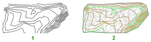
Contour data can be added only to TIN surfaces.

|
 Watch Video: Add Data to a Surface
Add contour data to an existing surface definition. |
 00:01:59
 No Audio