Data Table displays geospatial features in a tabular format. Data View displays external data linked to drawing objects. Feature class forms display attribute data for industry model features.
Data Table
Use the Data Table to highlight data for specific geospatial features in your map. AutoCAD Map 3D toolset maintains the link between spatial data and attribute data; when you update the attribute data, the updates are dynamically reflected in your drawing.
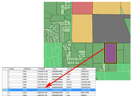
The Data Table displays geometry and attribute data for a feature. You can search and theme features based on any data in the feature source.
To display the Data Table
- Select a feature layer in the Display Manager.
- Click Table.
Forms
When you use an industry model drawing , you can also use forms to edit attribute data for individual features.
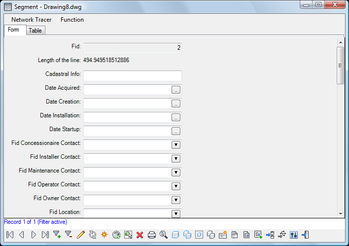
Forms display attribute information for a single feature.
Data View
Using the Data View, you can sort and filter the external database records linked to drawing objects. In addition, if you open the table in Edit mode, you can edit the data in the database table.
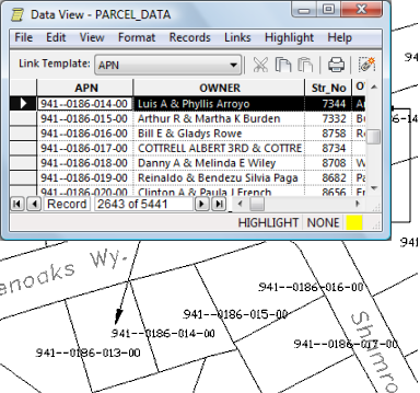
Data View displays external data linked to a drawing
To use the Data View
- To view or edit a table, double-click it in Map Explorer.
- To create or edit links to a table, double-click its link template.
- To run a query, double-click the database query name.
To continue this tour of AutoCAD Map 3D toolset, go to Status Bars