 Rubber sheeting is a nonuniform adjustment of a data set based on the movement of known control points to new locations. For example, data collected by aerial survey may be inaccurate because of flight alignment and camera inaccuracies. By comparing this data with accurate ground survey data, the aerial data can be stretched or rubber sheeted over the accurate data using control points and monuments common to both data sets.
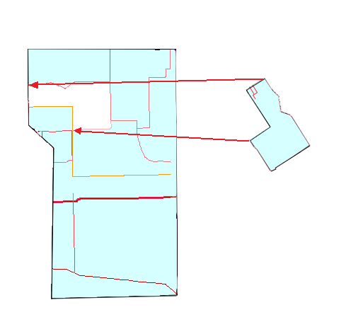
The reference map is correct, but the map with new details is severely distorted. By running the Rubber Sheeting command and selecting common control points, the two maps can be correctly aligned.
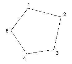
When selecting points for rubber sheeting, select points in order around the perimeter of the object or region to be rubber sheeted.
 correct |
 incorrect |
The selected points are treated as the vertices of a polygon, so you will get better results if you select the points sequentially around the perimeter.
Objects that have a given shape, such as circles, arcs, and ellipses, retain their original shape.
Because rubber sheeting is not a linear transformation, it is difficult to reverse the effects of the transformation and return a drawing to its original state. You should save your drawing before you perform a rubber sheeting operation.
Changing Scale
If you are working with two maps that have different scales and coordinate systems, first decide which coordinate system to use for the reference map. Then set the coordinate systems for the current and source maps.