Select a geospatial feature in your map and specify the distance for the buffer. AutoCAD Map 3D toolset creates a polygon around the feature or features you have selected at the distance you specify.
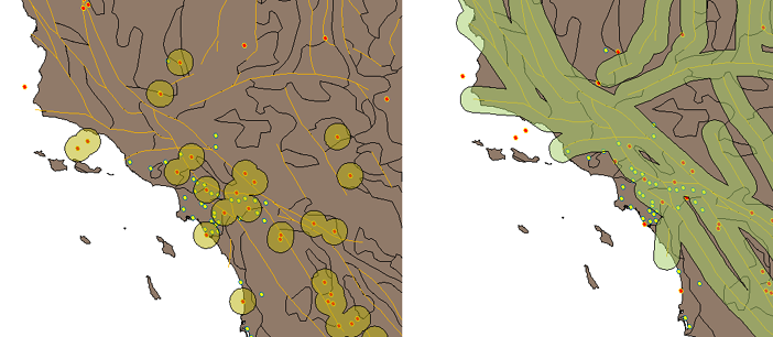
Buffers around point features (earthquakes) and along linear features (fault lines).
You can output the buffer to a new layer in your map or append it to an existing buffer layer. If you are buffering multiple features, you can specify whether AutoCAD Map 3D toolset should merge all the buffers into a single buffer, merge only the overlapping buffers, or leave the buffers separate. AutoCAD Map 3D toolset saves buffer data in SDF format.
You can use buffers to select features within the specified buffer distance of other features. For example, if you created a one-mile buffer around a construction zone, you could use this buffer to find all parcels within one mile of the construction area.
Buffer Warnings
If you select a very large number of features to buffer, AutoCAD Map 3D toolset will display a warning and give you the option of reducing the number of features in your selection. AutoCAD Map 3D toolset will also display this warning if you have selected features with very complex geometry, or if you have selected merge options for too many features or features with complex geometry.