Displaying Solid Filled Strata in a Subsurface Profile in the Geotechnical Modeler
The Geotechnical Modeler can automatically generate solid fill patterns for the various strata layers depicted on the profile view. This allows you to configure and customize the hatch patterns manually to reflect additional detail in the subsurface visualization, to accommodate discontinuities, and to incorporate the engineer’s interpretation of the subsurface data in a simple manner.

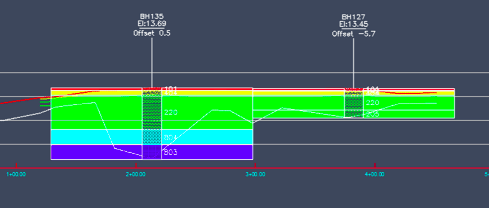
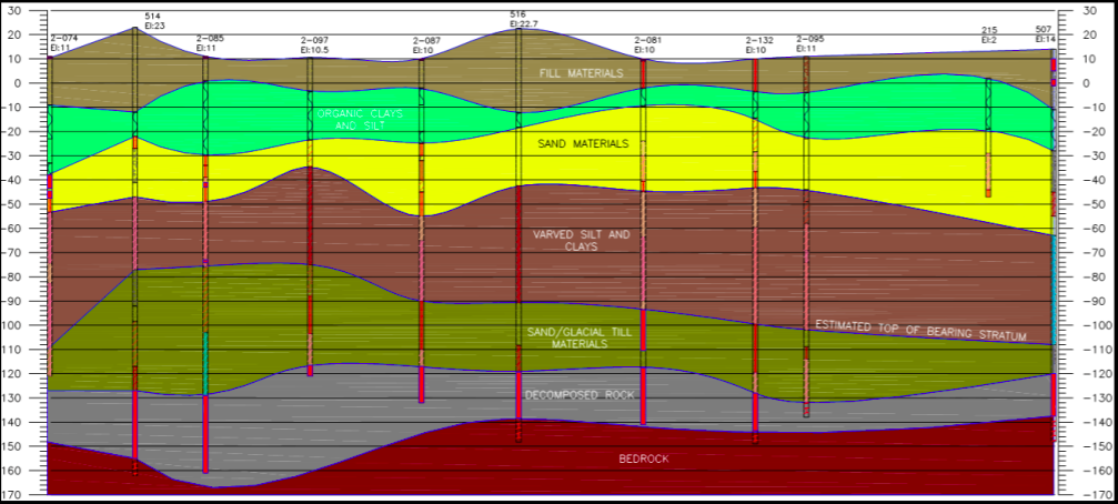
The image above shows how the solid filled strata is originally generated. Solid hatching is created for each stratum layer displayed in the sticklog, extending horizontally from the outside edge of the sticklog to the midpoint between that sticklog and the next. This provides the basis for creating exhibits like the example shown below.

To create the solid filled strata:
- Open the Subsurface Profiles dialog box by selecting Subsurface Profiles from the ribbon. : the Reference Alignment name listed in the uppermost drop-down menu. This is the alignment from the drawing in which the associated profile view will be updated.
- From the bottom of the dialog box select the check box for Solid Filled Strata.
- Select Create Subsurface Profile or Update Subsurface Profile to redraw the profile view.
- You can modify the boundary of the solid filled hatch patterns to further interpret the model data and create a more compelling visualization.