Use the Grade Extension By Reference command to edit an elevation by extending the grade of a segment on another feature.
This command is used to apply the same grade from a segment across a gap to a point on another feature line. For example, you can extend a grade across an intersection.
- Click
 Find .
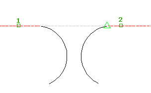
 - Select the reference segment.
The segment is highlighted and the grade and slope are displayed in the command line.
- Select the feature line or an other object that you want to edit.
As the cursor is moved along the feature line, it snaps to the nearest point that you can edit, displaying a yellow line from the reference point to the edit point.

- Specify the point.
The grade, slope, elevation and distance to the point are displayed in the command line.
- Press Enter to use the default reference grade. Do one of the following:
- Enter a grade. The grade is applied between the reference point and the point on the feature line.
- Enter Slope and then enter a slope. The slope is applied between the reference point and the point on the feature line.
- Enter Difference and enter the elevational difference. The elevational difference is applied between the reference point and the point on the feature line.
The assigned elevation for the point is displayed at the command line.
- Enter the grade to that point. The reference grade is the default.
- Select another reference segment. Press Enter to end the command.