Use sites to collect or group collections (parcels, alignments, gradings, and feature lines) by a topology that they have in common.
In Autodesk Civil 3D, you can manage objects with a common topology in a collection called a site. The objects that share in the topology are parcels, alignments, gradings, and feature lines.
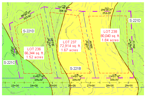
Examples of sites include soil maps, watersheds, or subdivisions. Sites can geographically overlay each other as is shown in the following illustration, while remaining independent. For example, a soils map and a subdivision with roads and lots can overlay each other, but remain independent of each other. Therefore, a parcel in a soils site would never be affected by an alignment in a subdivision site, even if their extents overlap.
All objects in a site topology collection share a common topology and have relationships to each other.
When you create parcels and gradings, you specify a site for them. If you create these objects before explicitly creating a site, a default site named Site 1 is created for them.
When you create an alignment or a feature line, you may either accept the default <none> site selection, place the alignment or feature line in an existing site, or create a new site. Accepting the <none> site selection places the alignment or feature line in a top-level Alignments or Feature Lines collection in Prospector, instead of within the Site collection.
When an alignment is placed in a site, it will create parcels if it forms closed regions and subdivide existing parcels in the site if it crosses through them. Accepting the <none> site selection prevents it from forming or interacting with parcels or any other objects.