AutoCAD Map 3D toolset acts as a hub for managing large amounts of spatial data.
- Use Schema Editor to create new schemas.
- Add and delete features and properties in existing schemas.
- Use Data Connect to create a data store from within AutoCAD Map 3D toolset.
- Export DWG data to Oracle format or Autodesk SDF.
- Export your entire map to DWG format.
- Use Bulk Copy to copy data from one data store to another.
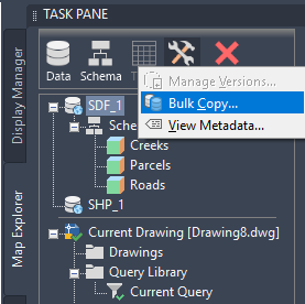
Use Bulk Copy to convert data from one geospatial format to another.
The Spatial Data File (SDF)
The spatial data file (SDF) format lets you store geometry and attribute information in a file-based geospatial format.
SDF can hold more information and has faster performance than DWG. SDF supports rich geometry, multiple tables, and spatial indexing.
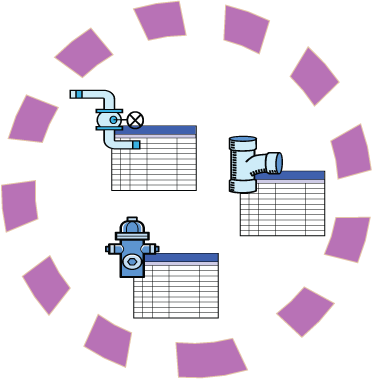
The circle represents an SDF file with a single schema that defines three feature classes: valves, pipes, and hydrants.
- Use Data Connect to connect directly to an SDF file. Any edits you make are made to the SDF file.
- If you import data from SDF, the imported data becomes drawing objects in your map and the live connection to the SDF file is broken. Importing is one way to convert the data from SDF to DWG.
- You can copy data to SDF format from other geospatial formats, and from SDF to those formats, using Bulk Copy.
Tell me more
|
|
|
|
|
 Procedure
 Related topics
Tell me more (Web Help Only)
|
|
|
|
|
 Video
Video
 Tutorial