Use AutoCAD Map 3D toolset to work with both CAD objects and geospatial features. You can combine them in your map, edit either type of data, and move data from one format to the other.
Combine data from drawing files and geospatial data stores.
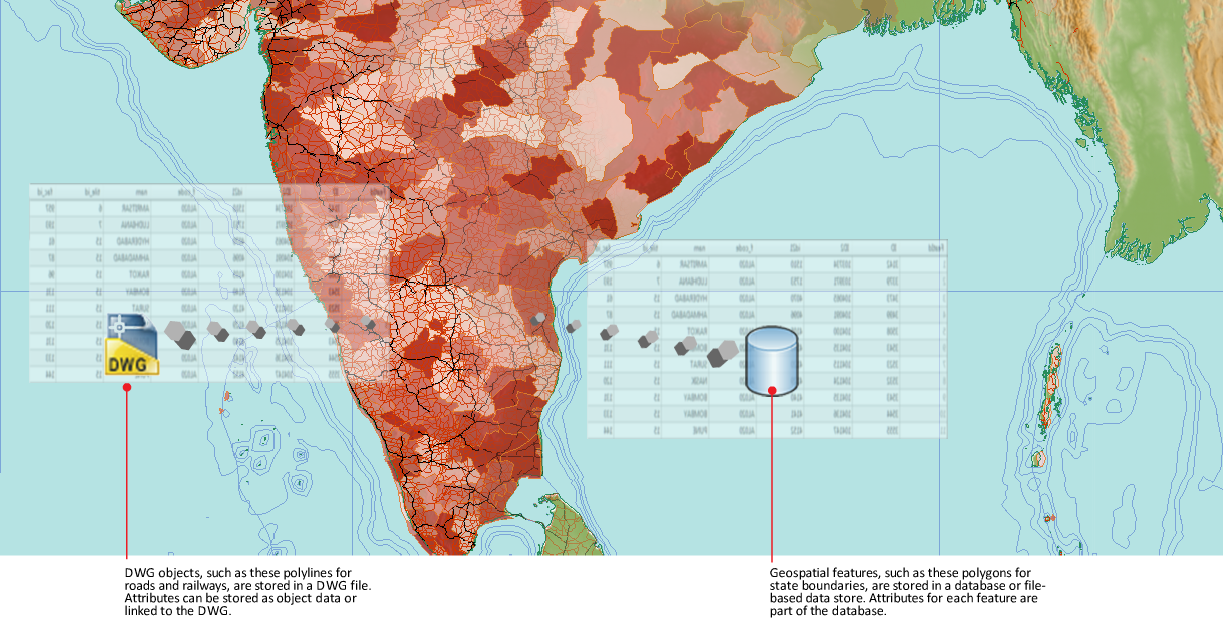
Geospatial Features
A feature is the spatial description of a real-world entity such as a road or a utility pole. Features are stored in a spatial database or in file formats such as Oracle, SDF, or SHP. The spatial database or file is referred to as a feature source.
Using Open Source FDO Data Access Technology, AutoCAD Map 3D toolset natively accesses spatial data. To work with features, connect to the database or file and then select the sets of features (feature classes) to include in your map.
Drawing Objects
A drawing object is any object in a DWG file, such as a line, circle, or closed polyline.
Create and store drawing objects in the current map, or attach a DWG file to the current map and query in its objects. AutoCAD Map 3D toolset remembers the original location of the objects and saves edited objects back to their original file.
Tell me more
|
|
|
|
|
|
|
|
 Procedures
 Tutorial
 Related topics
 Video
Video