A map file is a drawing that connects to all the sources for your map: geospatial features, drawing objects, raster images, and attribute data.
Each map file can contain multiple display maps (for printing or for online distribution), in which you can selectively hide or show items in your map. Maps exist only as conceptual structures, and are not separate entities or files.
You can apply styles to the items in a display map, based on data, layers, and other criteria. Changes that you make to the appearance of items in a map do not affect the actual data in your map file.
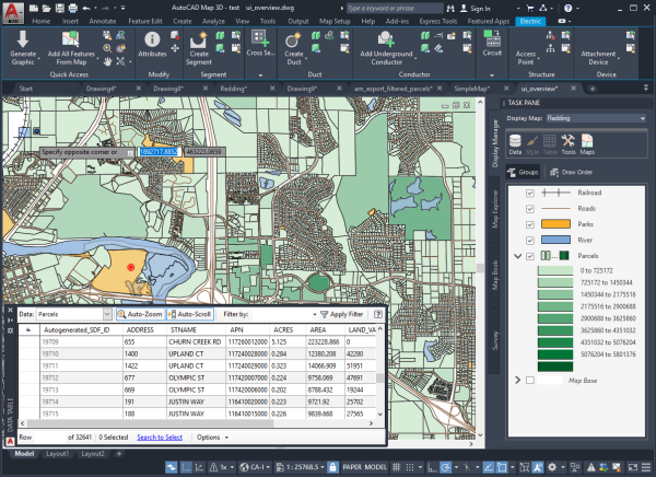
This map has Display Manager layers for railroads, roads, parks, the river, and parcels. Each is styled differently. For an introduction to the parts of the AutoCAD Map 3D toolset window, see Lesson 2: Take a Quick Tour of AutoCAD Map 3D Toolset.
Tell me more
|
|
|
|
|
|
|
|
 Procedures
 Tutorial
 Related topics
 Video
Video