Attribute data is non-geometry data about a drawing object or feature. For example, a drawing of parcels can have attribute data that lists the owner and improvements for each parcel.
For drawing objects, you can do the following:
- Import attribute data.
- Attach drawing objects with links to external data.
- Link database entries to the data already associated with drawing objects.
- Create and manage attribute data within AutoCAD Map 3D toolset using Data View.
- Use attribute data as the basis of queries.
- Display attribute data on your map as text.
- View attribute data linked to drawing objects using the Data View.
For geospatial feature data, you can do the following:
- Join an attribute data store to an existing feature class.
- Create and manage attribute data within AutoCAD Map 3D toolset.
- Use attribute data as the basis of queries.
- Display attribute data on your map as text.
- View and edit attribute data for features using the Data Table.
For industry model drawings , you can do the following:
- Edit attributes for an individual feature using forms.
Data Table
Use the Data Table to highlight data for specific features in your map. AutoCAD Map 3D toolset maintains the link between spatial data and attribute data; when you update the attribute data, the updates are dynamically reflected in your drawing.
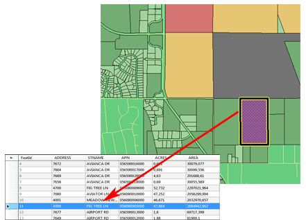
The Data Table displays geometry and attribute data for a feature. You can search and theme features based on any data in the feature source.
Data View
To link attribute data to drawing objects, attach the database to the current map. Then use a link template to connect the data to the objects.
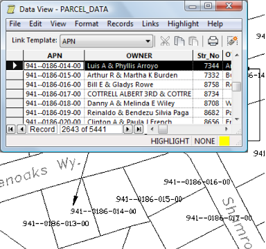
Link attribute data to drawing objects, then highlight objects in your map by selecting the linked data in the table.
Forms
Select any individual feature and display its attributes in a feature class form. Update the information and see the changes in that form as well as in the Data Table.
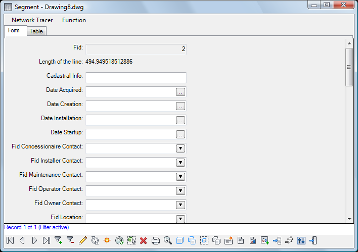
Forms display attribute information for a single feature.
Tell me more
|
|
|
|
|
|
|
|
 Procedures
 Tutorial
 Related topic
 Video
Video