Learn about new features in this release of AutoCAD Map 3D 2026 toolset. For technical details, see the release notes.
Highlights

Quality improvements
- AutoCAD Map 3D 2026 now allows working with drawings and FDO data sources in Autodesk Docs. To access Autodesk Docs, install Autodesk Desktop Connector. Save drawings with FDO connections to any file format from an Autodesk Docs folder, such as SHP, SDF, SQLite, or raster data, in Autodesk Docs. Then, open them from any local machine with all FDO connections intact.
- Extended support for the following FDO providers to newer versions:
- FDO PostGIS: PostgreSQL 16.4 / PostGIS 3.4
- FDO MySQL: MySQL 8.4
- The Display Manager (Draw Order tab) now allows adjusting the layer order using new shortcut menu options: Move to Top and Move to Bottom.
- The form of an industry model feature class now includes the Use the current record as Reference option when creating a new reference record. If selected, this option allows specifying the reference attributes to be included.
- AutoCAD Map 3D now provides more informative messages when editing attributes on the form if there are errors in the inputs.
- The Save Current Map to AutoCAD dialog box (MAPTOACAD command) now includes options to select the method for converting line style thickness (MAPTOACADUSELINEWEIGHT system variable).
- When loading a layer containing an expression error or layer definition errors in AutoCAD Map 3D, the Display Manager displays the layer error icon. It also shows the corresponding error tooltip prompts. The same behavior occurs when opening a layer with these errors in an industry model.
The following customer issues have been resolved in AutoCAD Map 3D 2026 toolset.
- Annotation: AutoCAD Map 3D no longer crashes when deleting multileader annotations.
- FDO WMTS: Fixed connection and display issues for some WMTS.
- FDO WMS
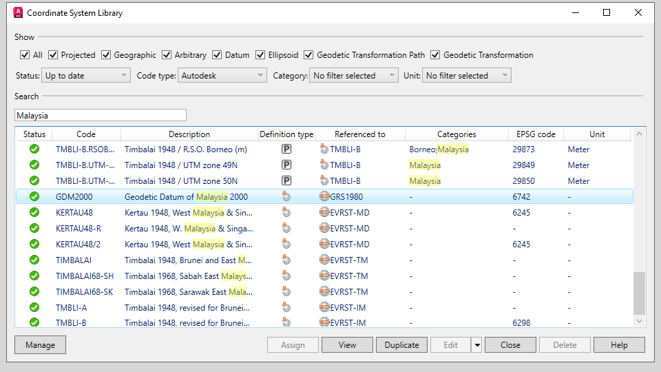
- The Data Connect dialog box now includes a new Choose coordinate system option in the Server CS code drop-down list, allowing selection of a different coordinate system from the CS library.
Fixed data connection problems for some WMS.
- The Data Connect dialog box now includes a new Choose coordinate system option in the Server CS code drop-down list, allowing selection of a different coordinate system from the CS library.
- FDO WFS: Fixed connection and display issues for some WFS.
- FDO PostgreSQL: AutoCAD polylines now correctly convert to line features and save to the PostgreSQL database.
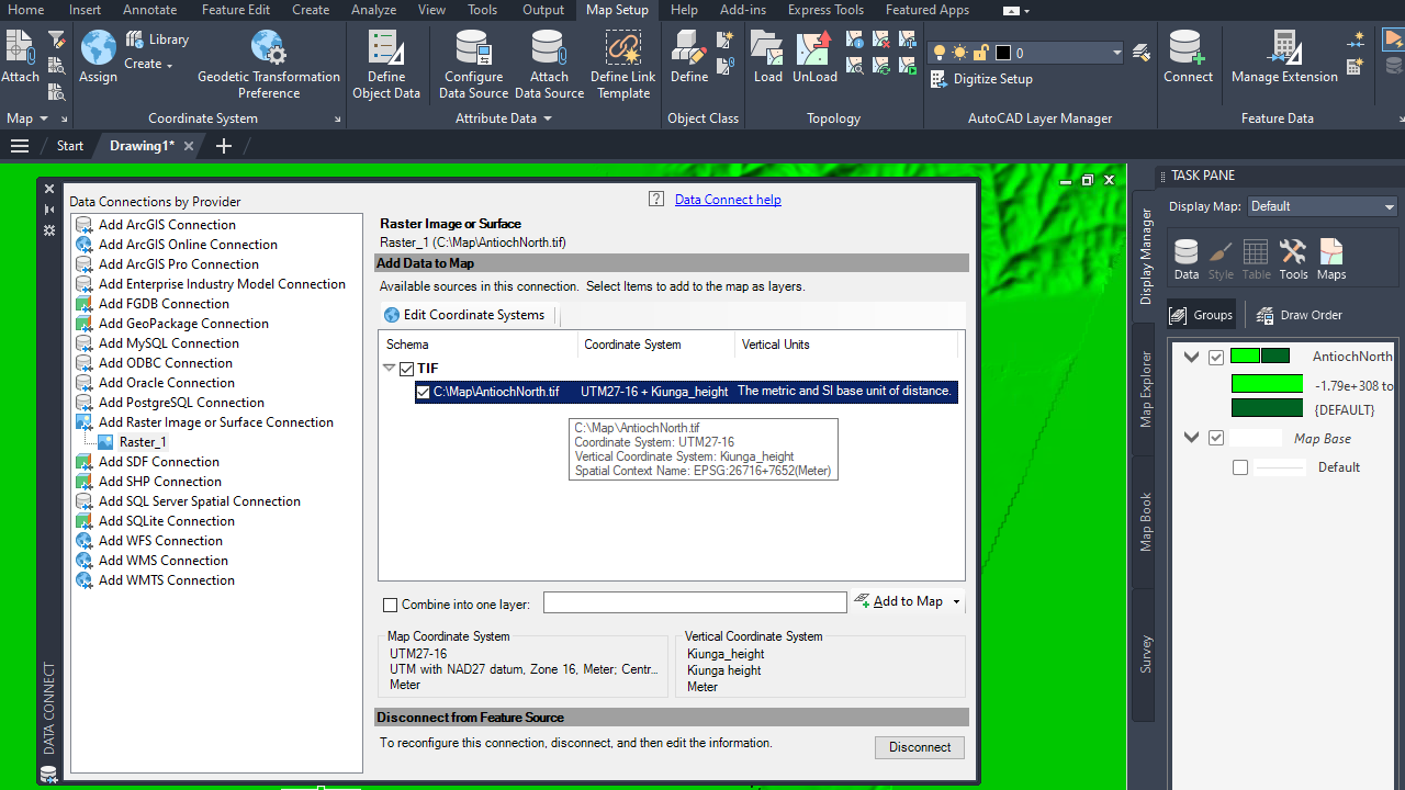
- FDO Raster: ECW raster images now display correctly after being added to the map.
- Layout and Viewports: For drawings with multiple layouts whose viewports are connected to a north arrow, AutoCAD Map 3D now keeps all viewports connected to the dynamic north arrow when executing some commands and reopening the drawing.
- MAPTOACAD Command
- The MAPTOACAD command no longer crashes when working with drawings that have symbols in different layers with the same name, color, and size.
- The MAPTOACAD command now displays the correct color in the results for specific industry model drawings.
- For drawings containing FDO Raster connections, the MAPTOACAD command now works as expected.
- MAPCREATECENTROIDS Command: The MAPCREATECENTROIDS command now works as expected.
- MAPFEATURESPLIT Command: The MAPFEATURESPLIT command now correctly splits polygon features with Z dimensions from SHP files.
- Import and Export: AutoCAD Map 3D no longer crashes when exporting objects to Esri Shapefile or Google KML/KMZ file format for a drawing with a user-defined coordinate system.
- Industry Models
- AutoCAD Map 3D no longer crashes when digitizing pipe areas in electric models.
- AutoCAD Map 3D no longer crashes when selecting more than one polygon as the job perimeter for industry models on Oracle 19c.
- AutoCAD Infrastructure Administrator no longer crashes when creating a new job template for projects with specific industry model settings.
- AutoCAD Map 3D now strictly complies with the settings defined in Infrastructure Administrator regarding creating or not creating a label.
- AutoCAD Map 3D now shows values with the correct decimals for number attributes.
- For file-based industry models with EPSG:31370 coordinate system, creating new features no longer results in offsets to the selected locations.
- Topology connections are no longer broken after importing new objects with the Validate after conversion option enabled in the Convert to Industry Model dialog box (MAPCONVERTTOMODEL command).
- OSNAP works as expected with large data from a view layer in the industry model.
- Print preview and plot now work as expected when the drawing contains complex polygons.
- Actions in forms can now be triggered with a click.
- Export to Excel works as expected when the form contains a filter.
- Clearing the history of conflicting features now works as expected.