This dialog is displayed from the GIS Layer Control dialog when Layer Type is set to File Geodatabase and you click Add Layer.
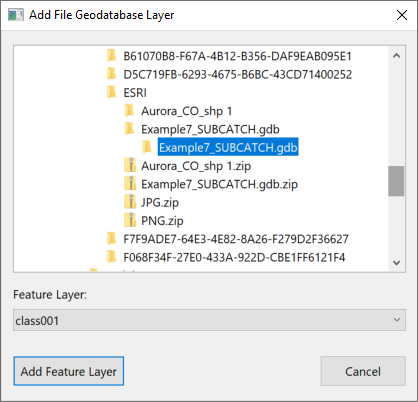
It is used to select which feature layers from a File Geodatabase are to be used as additional GIS layer in the GeoPlan window. First select the folder that contains the File Geodatabase, then select the feature layer that contains the data you wish to display in the GeoPlan.