Estimating QMED from catchment descriptors
QMED is used as the index flood in the Flood Estimation Handbook. “QMED is formally defined as the middle ranking value in the series of annual maximum floods, where the annual maximum series comprises the largest flow observed in each year.”
The FEH catchment descriptor methods are applicable to catchments no smaller than 0.5 kms (50 ha).
The accuracy of QMED calculated from the above catchment descriptors may be significantly improved through data transfer from donor catchments. This technique is described in detail in FEH volume 3, chapter 4.

Input Variables
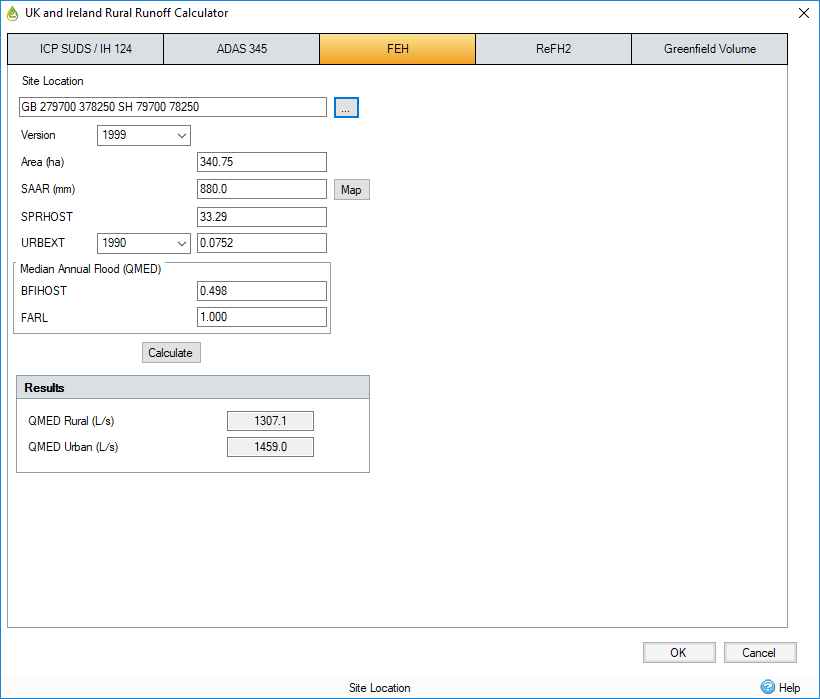
Site Location - Click the dotted button to import the FEH rainfall details. The Open FEH Details box will appear. Locate the file that was exported from the FEH CD or web service and open it. This descriptive field allows the site location to be recorded. If the FEH details are imported from a .csv/xml file, then this field is filled in with the grid reference details.
Area - Catchment area (km²) converted to ha.
SAAR - Standard average annual rainfall 1961-1990 (mm). This can be loaded in by selecting the Map button and choosing the Site location.
SPRHOST - Standard percentage runoff derived from HOST soils data.
URBEXT - The extent of urban and suburban cover. Either select the 1990 or 2000 values if available or simply enter a user-defined value. Note that the year 2000 values are only available if using the FEH CD-ROM Version 2. If values for 1990 or 2000 are zero, please check the values as they may not be available from the FEH data.
BFIHOST - Baseflow index derived from Hydrology of Soil Types (HOST) soils data.
FARL - Index of flood attenuation due to reservoirs and lakes.
Output Variables
QMED rural (l/s)
The median annual maximum flood in the as-rural state is calculated using the following formula (equation yields m³/s):
![]()
QMED urban (l/s)
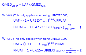
The median annual maximum flood is calculated using the formula below (equation yields m³/s):

