The SCS Rainfall Method was developed by the United States Department of Agriculture - Natural Resources Conservation Service (USDA-NRCS).
InfoDrainage's implementation of the NRCS SCS rainfall uses the same synthetic 24-hour storm profiles that form the basis of the rainfall portion of the NRCS hydrology procedures described in TR-55. In particular the synthetic hyetographs (Type 1, 1A, 2 and 3) described in Appendix B of TR-55, which are widely used in the United States for watershed and stormwater design.
When used with the corresponding runoff procedures, these storm profiles align with the TR-20/TR-55 hydrologic framework commonly accepted for United States design and permitting.
Use the controls described below to generate SCS rainfall to be run by the analysis.
Parameters
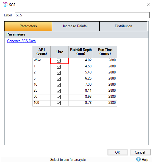
Generate SCS Data
This link directs users to the National Weather Service website. Users can look up the appropriate rainfall details for their area if they do not already know or locally specified.
ARI Events Spreadsheet:
ARI (years) - A range of typical Annual Recurrence Intervals (ARI) listed for the SCS method.
Use - Check the ARIs to be solved during the Analysis.
Depth - Cumulative depth multiplier to the SCS hyetograph distribution - discussed below.
Run Time - Simulation run time, by default this is twice the hyetograph duration (24hours for standard SCS hyetograph).
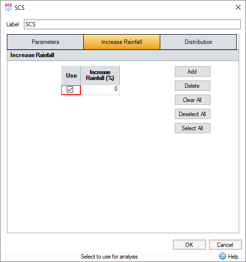
Increase Rainfall
This will scale all rainfall by the amount specified. This can be used to take climate change, or other factors, into account.
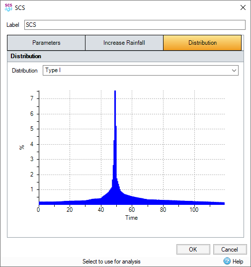
Distribution
SCS hyetograph distributions Type 1, 1A, 2 and 3 are available by default, and are aligned with those in Appendix B of Technical Release 55. If an SCS hyetograph other than these is desired it is recommended to use the Design Storm (User Defined) option.