Surface Layers
Manage the order and visibility of surface and sub-surface layer data such as ground imagery, as well as the model terrain You can also create new surface or sub-surface layers.
Click Manage ![]() Display
Display ![]()
![]() (Surface Layers) to open Surface Layers. You can use this tool to add or modify surface layers.
(Surface Layers) to open Surface Layers. You can use this tool to add or modify surface layers.
Note: You can also toggle the display of surface layers on or off in the cross section view tab of the Profile View.
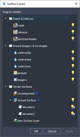
Hide/Show Layer
![]()
![]()
Hide or show surface layers in the model. When the light bulb image is yellow, the surface layer is displayed; when it is white, the surface layer is hidden.
Features that conform directly to the terrain (terrain, coverage, water, railways, and roads) are considered "surface layers." The Hide/Show control for those features controls their display as a group.
Surface Layer Settings

Indicates that a surface layer has settings that can be modified in the stack.