To Export InfraWorks Features to File Geodatabase (FGDB) Format
You can use the Export to FGDB command to export the following InfraWorks feature types to a file geodatabase that can be used in ArcGIS Online or in another application:
- Barriers
- Buildings
- City Furniture
- Coverages
- Culverts
- Drainage End Structures
- Easements
- Grading Areas
- Parcels
- Parking Areas
- Parking Rows
- Pipelines
- Pipe Connectors
- Points of Interest (POIs)
- Project Sites
- Railways
- Right of Ways
- Roads
- Streams
- Traffic Study Areas
- Trees
- Water Areas
- Watersheds
The Export to FGDB command saves the file geodatabase to a specified folder and it does not require an ArcGIS account or publishing privileges.
To export objects to FGDB
Click the Present/Share tab
 Share
Share  (Export FGDB).
The Export to FGDB dialog displays.
(Export FGDB).
The Export to FGDB dialog displays.Define the export extent in your model using the Extent section of the dialog
Assign a Target Coordinate System if one is not assigned already.
Specify the save location for the exported file(s) using the Target File(s) section of the dialog.
Select whether to export all feature types or a choose specific feature types to export in the Select Feature Type section of the dialog.
Click Export. The Export to FGDB dialog appears.
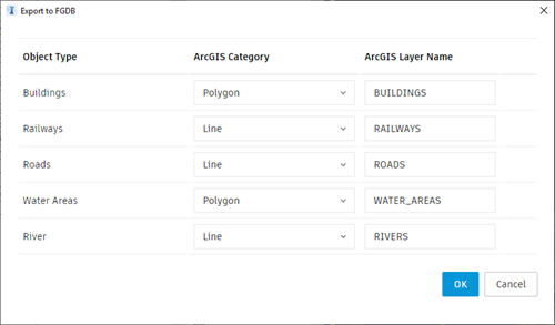
Map the exported InfraWorks feature types to what will be the resulting ArcGIS Category and Layer Names.
Click OK. Note: Some coordinate systems are not supported when publishing to ArcGIS or exporting to FGDB.
If a model is assigned an unsupported coordinate system, publishing to ArcGIS or exporting to FGDB will not proceed.
In addition, there are three categories of coordinate systems which are not supported:
- Obsolete Coordinate Systems
- Arbitrary X-Y Coordinate Systems
- Test Only Coordinate Systems
See Coordinate Systems Not Supported When Exchanging Data with ArcGIS in the Autodesk Civil 3D help for more information.