About Watershed Analysis
Identify and analyze all watersheds intersecting a selected component road or identify watersheds from a single low point in the terrain.
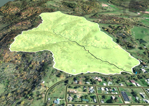
- A single analysis may identify multiple watersheds. Each watershed is a selectable feature. Click inside a watershed to display its properties on the stack.
- Drainage Design displays watershed extents and stream locations, and marks where streams cross roads with a blue balloon pin.
- Analysis uses the existing ground surface prior to placement and grading of a component road. Analysis aims to identify existing drainage patterns prior to road placement and design.
Note: Beginning August 1st, 2024, the Watershed Analysis cloud service will no longer be available in InfraWorks. A local version of the tool with the same capabilities has been integrated into the following InfraWorks versions:
- InfraWorks 2022.1 Hotfix 8
- InfraWorks 2023.1 Hotfix 3
- InfraWorks 2024.1
- InfraWorks 2025.0
Please update your InfraWorks to one of the versions listed above (or a more recent version) in order to be able to run the local Watershed Analysis.