To inspect superelevated roads, bridge decks, intersections, and turn zones
Use the Station Tracker and Cross Section Viewer to inspect superelevation through critical stations or for any other cross-section of the roadway. You can also modify maximum superelevation rate and runoff parameters for the entire component road in the Stack.
Select a component road.
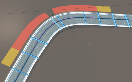
Apply superelevation to the component road. Superelevation critical stations are marked with blue slices across your component roadways.

The yellow-to-red superelevation track alongside the component road represents runoff, runout, and superelevated regions. Hide your ground imagery to improve visibility of the runoff, runout, and superelevation.

- Yellow segments represent Runout.
- Amber segments represent Runoff.
- Segments with full superelevation will not have a color associated with it.
Single-click a critical station. The Station Tracker appears on the roadway as an orange slice to mark the location you selected.
 Note: Click-and-drag the Station Tracker along the roadway to inspect superelevation for a different cross-section.
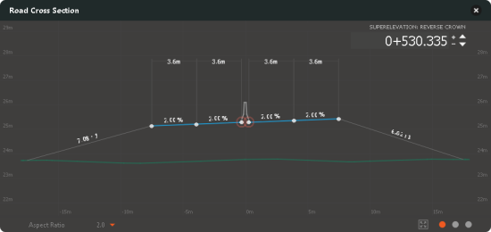
The Cross-Section Viewer displays when you select a location on the road with the Station Tracker. Use the cross-section viewer to inspect superelevation for the roadway cross-section where your Station Tracker is positioned. You can also display the Cross-Section Viewer with the right-click context menu.

- To modify bridge deck cross sections.
- To inspect superelevation through intersection areas.
- Click
 in the Cross-Section viewer to switch between Superelevation, Road Assembly, and Cut/Fill views of the roadway cross-section. See About the Cross-Section Viewer for more info.