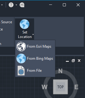
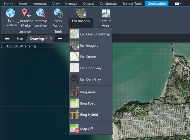
There are five new Esri maps available to assign geographic location information to drawings.
Now, you can use five additional types of Esri maps to assign geographic location information to a drawing file.
To open, click Insert tab > Location panel > Set Location > From Esri Maps.


Or from the command window, type GEOGRAPHICLOCATION and select Map.

Now, you can choose from five new Esri basemap styles:
- Esri OpenStreetMap
- Esri Imagery
- Esri Streets
- Esri Light Gray
- Esri Dark Gray
