
FDO Raster in AutoCAD Map 3D 2026 current offers support for vertical coordinate systems as a tech preview. What is a Tech Preview?
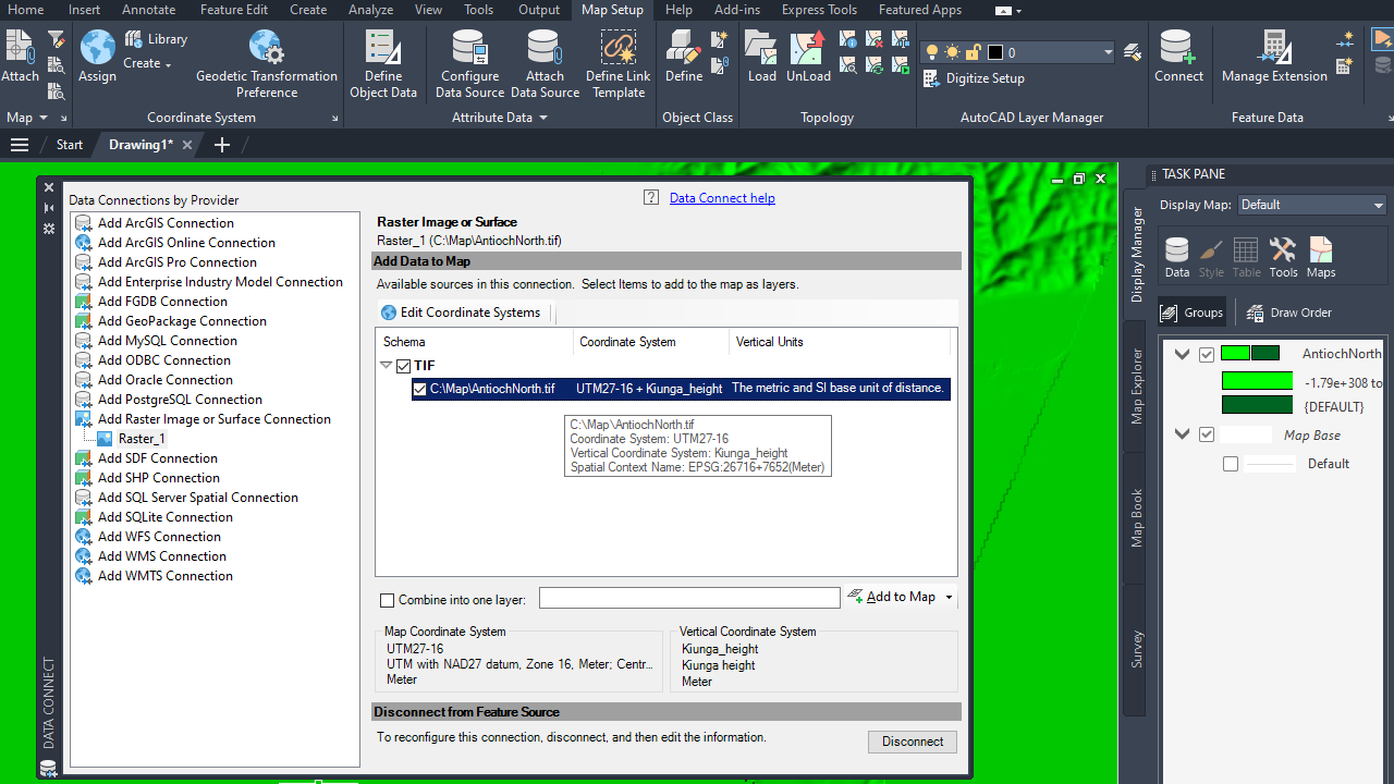
When a raster file has a vertical coordinate system and the MAPVERTICALCSENABLED system variable is set to 1, AutoCAD Map 3D 2026 displays both the horizontal coordinate system (HCS) and the vertical coordinate system (VCS) in the feature class list in the Data Connect dialog box.
You can choose to override the coordinate system if necessary. Once the data is added to the map, the drawing’s coordinate system in the status bar reflects both HCS and VCS. In the drawing, use the GEOCSASSIGN command to change the HCS or VCS, which then initiates the coordinate system transformation.
The table below displays a list of supported vertical coordinate systems.
| VCS Name | EPSG | Model | Direction |
|---|---|---|---|
| EGM2008_height | 3855 | Gravity-related | Positive up |
| ETRF89_height | Ellipsoidal | Positive up | |
| ETRF89.OSTN15_height | Ellipsoidal | Positive up | |
| EVRF2000_height | 5730 | Gravity-related | Positive up |
| EVRF2007_height | 5621 | Gravity-related | Positive up |
| EVRF2019mean_height | 9390 | Gravity-related | Positive up |
| Kiunga_height | 7652 | Gravity-related | Positive up |
| KSA-VRF14_height | 9335 | Gravity-related | Positive up |
| LN02_height | 5728 | Gravity-related | Positive up |
| LHN95_height | 5729 | Gravity-related | Positive up |
| NAD_1983_2011 | Ellipsoidal | Positive up | |
| NAVD88_height | 5703 | Gravity-related | Positive up |
| ODN_height | 5701 | Gravity-related | Positive up |
| POM08_height | 7841 | Gravity-related | Positive up |
| WGS_1984 | Ellipsoidal | Positive up |