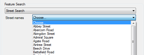
Using Feature Search, you can quickly find the location of a certain object, such as a building, parcel, or any other industry model feature that has geometry. The detected geometry becomes the center of a graphic generation or a zoom Go To.
Feature Search is based on search definitions that can be arbitrarily defined. The definitions are stored in the industry model in the system table TB_POSITION_FINDER. That means that you can define special search definitions for each industry model.
Both AutoCAD Map 3D and Infrastructure Application Extension use Feature Search to generate graphic using geographical selection.

In the Feature Search group box, you can specify a map center by selecting a certain object. The searches can be defined with the Feature Search Administrator. This search is of the search type sequential with input type combo box.
There are three types of Feature Search definitions:
- Sequential Search — A sequential search improves from one level to another. At the end, you get the feature you want. For example, you first select a city, then the street, and finally a building. The sub-searches can be defined with selection lists or text boxes.
- Flat Search — With a flat search, you fill in what you know about the location to find. AutoCAD Map 3D searches the data source for all matching results. Select the result as the center of the graphic generation process.
- Plug-in search — Use a plug-in search if the geometries do not exist in the database. The coordinates for the bounding box come from memory. You can code plug-ins, which return coordinates from given parameters. For more information refer to the developer’s documentation.
See also: Feature Search Reference.
Steps in this workflow: