Import coverages and configure them as avoidance areas, or sketch avoidance areas using the Corridor Optimization (preview) panel. Avoidance areas are included as cost zones when you generate an optimized road corridor.
To sketch an avoidance area for corridor optimization
- Click


 .
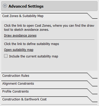
. - In the Corridor Optimization panel, click Advanced Settings.
- Click Cost Zones & Suitability Map.

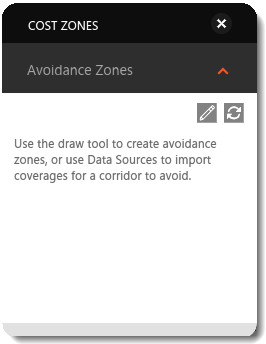
- Click Draw Avoidance Zones to display the Cost Zones asset card.

- Click
 in the Cost Zones asset card to sketch a polygonal avoidance area. Double click to finish.
To import an avoidance area for corridor optimization
- Enable the Corridor Optimization preview service from InfraWorks Home.
- Open the desired model or proposal.
- Import a polygonal area represents your avoidance area. Import avoidance area polygons from Autodesk AutoCAD Civil 3D DWG, IMX, CityGML, LandXML, SDF, SHP, or SQlite files. You can also import polygons through an FDO database connection. See To import data.Note: The optimization process only recognizes imported polygons or areas that you sketch using the avoidance area sketching tool. To designate an avoidance area that you have already sketched in your InfraWorks 360 model, export that coverage to an IMX file and then reimport it into your model.
- Right-click on the data source you just added in the Data Sources panel, and select Configure.
- Set the Type field to Coverage Areas.
- On the Cost tab, select Include Environmental Impact And Associated Cost For Corridor Optimization. Set the Avoidance Type to Avoid.
- Click Close & Refresh to apply the settings to your model.
- Click


 .
. - Click Advanced SettingsIn the Corridor Optimization panel.
- Click Cost Zones & Suitability Map.
The coverage area is now listed as an avoidance area.
Note: See Suitability Maps (preview) Video for more information about defining suitability maps.