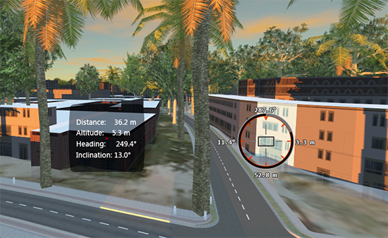
Use the Rangefinder to measure distances relative to your current view position in model.
- Zoom out so you can see the points to measure.
- Adjust the viewpoint so it appears as though you were standing at the starting point.
For example, to measure the distance from a rooftop to another building, zoom into the rooftop.
- Click


 .
.
- Click a target.
You can use the following keyboard shortcuts and commands:
Create a new instance with target and label. Makes range persistent. R key Show/hide paths for persisted ranges T key or space Change the rangefinder display 1 key Clear the most recent measurement Backspace Clear all current measurements Esc 
A label indicates the altitude, direction heading, and angle of inclination to the target. You can continue measuring distances between the viewpoint and other targets by clicking more end points. Each one is labeled separately.
Advanced Tips
The distance will be measured even if the line between the viewpoint and the target is blocked by other objects.
A label indicates the altitude, direction heading, and angle of inclination to each target you click. You can measure multiple targets in a session.
You can take a snapshot of each distance measurement as it is measured, but you cannot record this as part of a storyboard.
While you are measuring, you cannot select or edit features.