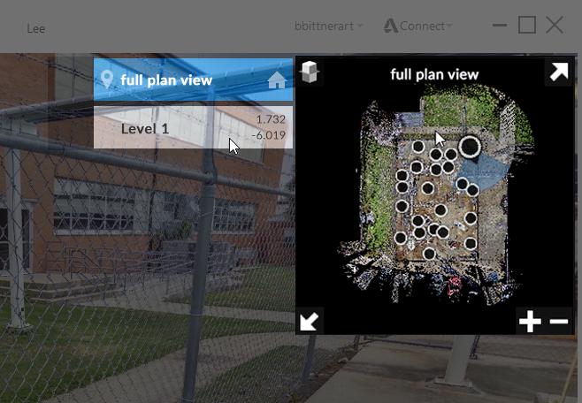
A top-down map of the project with interactive points associated with individual scans is available in the upper right hand corner of the viewer window. This widget provides feedback on the currently selected scan you are viewing as well as camera orientation. You also quickly navigate to other scans by clicking on them from within this widget.
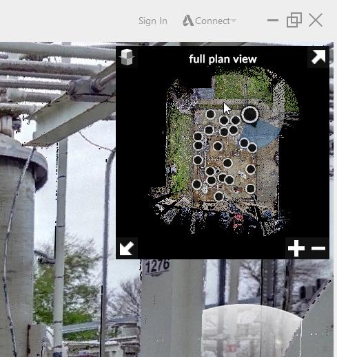
The minimap can be expanded and explored in full screen mode to give you a higher detail view. Navigation in this mode is the same as in the panorama viewer. Pan and zoom are available through left click and mouse wheel options.

By default, each project consists of all scan locations. For multi-level projects it can be helpful to split these up into individual levels. This can be done with the Elevation Slice tool located in the upper left of the minimap panel.

Clicking on the tool displays the list of all current elevations slices available and allows you to add and edit individual slices.
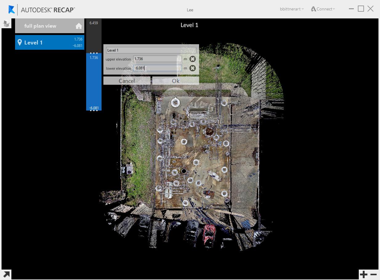
You can quickly switch between elevations by selecting the level you desire. These are available when the minimap is minimized by hovering over the tool icon. Available results are listed to the left of the minimap.