In this exercise you use Match to correlate an aerial photograph to a vector drawing.
Match applies linear correlation, adjusting insertion point, scale, and rotation as necessary, to align a raster image with known points in a vector drawing or with another image.
To match an image to a drawing, you select two source points on the image and two corresponding destination points in the drawing. AutoCAD Raster Design toolset uses these points as a reference to reposition the image relative to the drawing.
Related Exercises
Before doing this exercise, ensure that AutoCAD Raster Design toolset options are set as described in the exercise Exercise A1: Setting AutoCAD Raster Design Toolset Options.
Exercise
- In the \Tutorial5 folder, open the drawing file
Map_02.dwg.
Restore the viewport TU_match
- Click
View menu
 ViewportsNamed Viewports. Click the viewport
TU_match, then click
OK.
ViewportsNamed Viewports. Click the viewport
TU_match, then click
OK.
Match the first point
- Click
Raster menu CorrelateMatch.
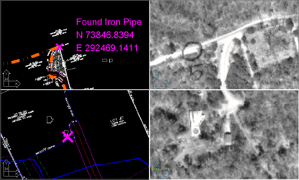
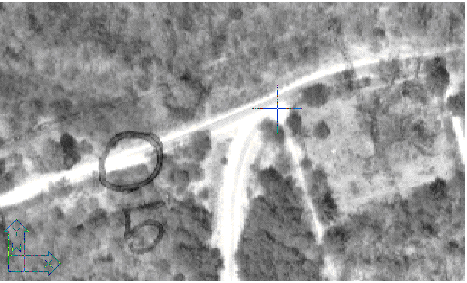
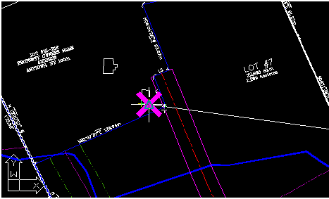
- For the first source point, select the upper right viewport, then select the source point on the image.
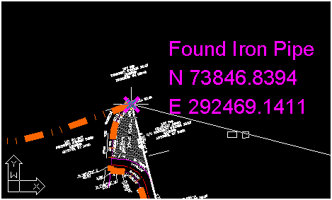
- For the first destination point, select the upper left viewport, then select the intersection of the stone wall and the parcel boundary, at the center of the X.
Match the second point
- For the second source point, select the lower right viewport, then select the source point on the image, at the lower right corner of the barn.
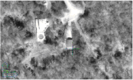
- For the second destination point, select the lower left viewport, then select the center of the X.
When you click the second destination point, the image immediately snaps into alignment with the drawing.
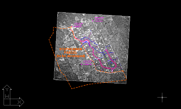
View the results of matching the points
- To set a single viewport, click
View menuViewports1 Viewport. Then zoom out to see the vector lines overlaid on the aerial photo.
- Close the drawing without saving changes.