You can add contour data to the composite surface from survey data.
The following workflow illustrates the option of adding LIDAR contour data to the surface created with the sample survey data. These are optional steps and may not be necessary or applicable to your design solution.
The example in this workflow is the field shown in figure 4. You can also drape an aerial photo of a surveyed field to the surface created with survey points.
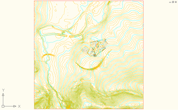
- To fill out the surface, you can use LIDAR contour data which should be set as a 5m grid dataset as shown in figure 7.

Figure 7: LIDAR data used to fill in the surface
- Create a new surface and paste the 5m grid and also the surveyed surface as shown in figure 8.

Figure 8: Result of pasting the surveyed surface
- Using Map import, import the aerial photo of the surveyed field, which includes a “World file” for positioning at the same coordinate system used. The result is shown in figure 9.

Figure 9: Importing the aerial photo
- Create a boundary around the aerial photo and add as a boundary to the composite surface.
Then, drape the aerial photo to the composite surface with the Drape Image command.

Figure 10: Aerial photo added as boundary and draped to the composite surface